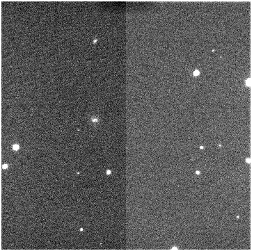
The LRIS guider imaging zero point is presented below. The Guider is equipped with a BVRI filter set. Known BVI-band standards in the m67 open cluster were used to calibrate the zero point. The ZP is defined to be the magnitude of a 1 ADU detection in 1 second of integration.
The photometry used for calibration comes from Montgomery et al. 1993 AJ 106 181. In the table below, the stars used in the measurements are listed along with the Flux measured in the 1, 3 and/or 10s images. The guider image was acquired using a gain setting of 0 => gain= 0.7 e-/ADU. The LRIS guider image used was centered at: 8:50:47.81 11:50:53.0 and had a pa of 0. A finder chart of the field is shown below.
The average zero points for the stars below are: B=27.9, I=27.6 mag. The observations were originally made at an airmass of 1.045 and a correction for airmass was not made. V-band was also measured, but the data was confused by the open position.
The sensitivity for the guider for a 1 second exposure was calculated. For this calculation, the objects are assumed to be measured in a 1 arcsec aperture, with the sky bg measured in an additional 1 arcsec aperture. The pixel scale was assumed to be 0.164 arcsec/pix for this calculation. For a S/N=10, the guider would detect a B=20.1 and I=19.3 mag object in 1 second.
#photometric measurements for offset guider
#airmass was 1.0469 for an average
lrisoffset_120516_221.fits:  FILTER2 = V
lrisoffset_120530_482.fits:  FILTER2 = V
lrisoffset_120602_859.fits:  FILTER2 = V
lrisoffset_120621_248.fits:  FILTER2 = R
lrisoffset_120639_648.fits:  FILTER2 = R
lrisoffset_120705_977.fits:  FILTER2 = R
lrisoffset_120720_302.fits:  FILTER2 = I
lrisoffset_120736_629.fits:  FILTER2 = I
lrisoffset_120749_793.fits:  FILTER2 = I
lrisoffset_120805_413.fits:  FILTER2 = B
lrisoffset_120817_668.fits:  FILTER2 = B
lrisoffset_120835_916.fits:  FILTER2 = B

# stars in the field			JANES magnitudes                Measured flux
ID	RA(1950)	DEC(1950)	ID	Vmag	B-V	V-I	V-1s	R-1s	I-1s	I-3s	B-1s	B-10s
1	08:48:02.170	+12:03:31.50	5179	15.009	0.799		-	259281	238158	-	109878	483319
2	08:48:01.670	+12:03:17.10	5174	14.426	1.029		-	460285	-	-	-	729300
3	08:48:04.531	+12:02:51.70	5209	19.908	1.499	1.437	20914	-	-	16029	-	-
4	08:48:05.410	+12:02:32.30	5223	16.436	1.211	1.381	482707	72400	108927	349534	19293	98771
5	08:48:02.850	+12:02:19.00	5185	18.424	0.612	0.869	225220	51495	49439	106606	-	-
6	08:48:07.000	+12:03:12.40	5235	18.330	1.430	1.718	79524	12941	22030	71430	-	-
7	08:48:08.150	+12:03:06.90	5253	19.685	0.707	0.976	15806	-	-	10284	-	-
8	08:47:59.580	+12:01:45.00	5154	19.229	1.373	1.344	85406	-	16279	62444	-	-
9	08:48:03.850	+12:00:57.10	5200	14.535	0.491		-	440754	337858	-	159669	-
10	08:48:03.400	+12:00:36.70	5197	19.662	1.469	1.409	18914	-	6414	16212	-	-
11	08:48:07.090	+12:01:25.20	5234	18.409	1.443	1.933	92610	11375	29865	94298	-	12936
12	08:48:08.040	+12:01:39.60	5247	18.564	1.570	2.759	131349	11158	58903	187819	-	11550
13	08:48:11.010	+12:01:32.70	5288	19.026	1.003	1.188	30727	-	5384	19484	-	14350
								sky=   ~610/pix  540	563	675	518	612

m67 8:50:47.81 11:50:53.0 Pa=0
Original data from 23 January 2010
Send questions or comments to:LRIS Support